Geospatial Data Catalogue
Our rich geospatial data catalogue covers the entire African territory and provides information on the following topics:
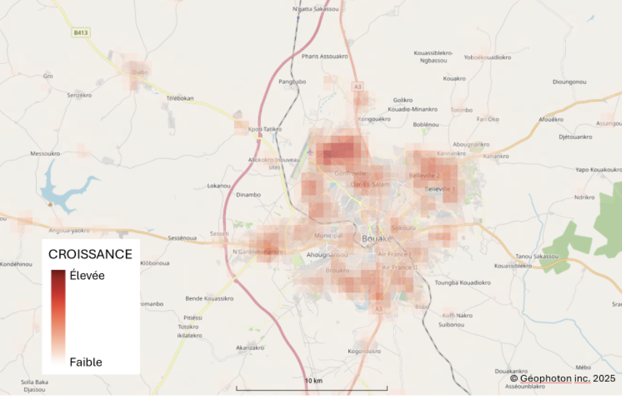
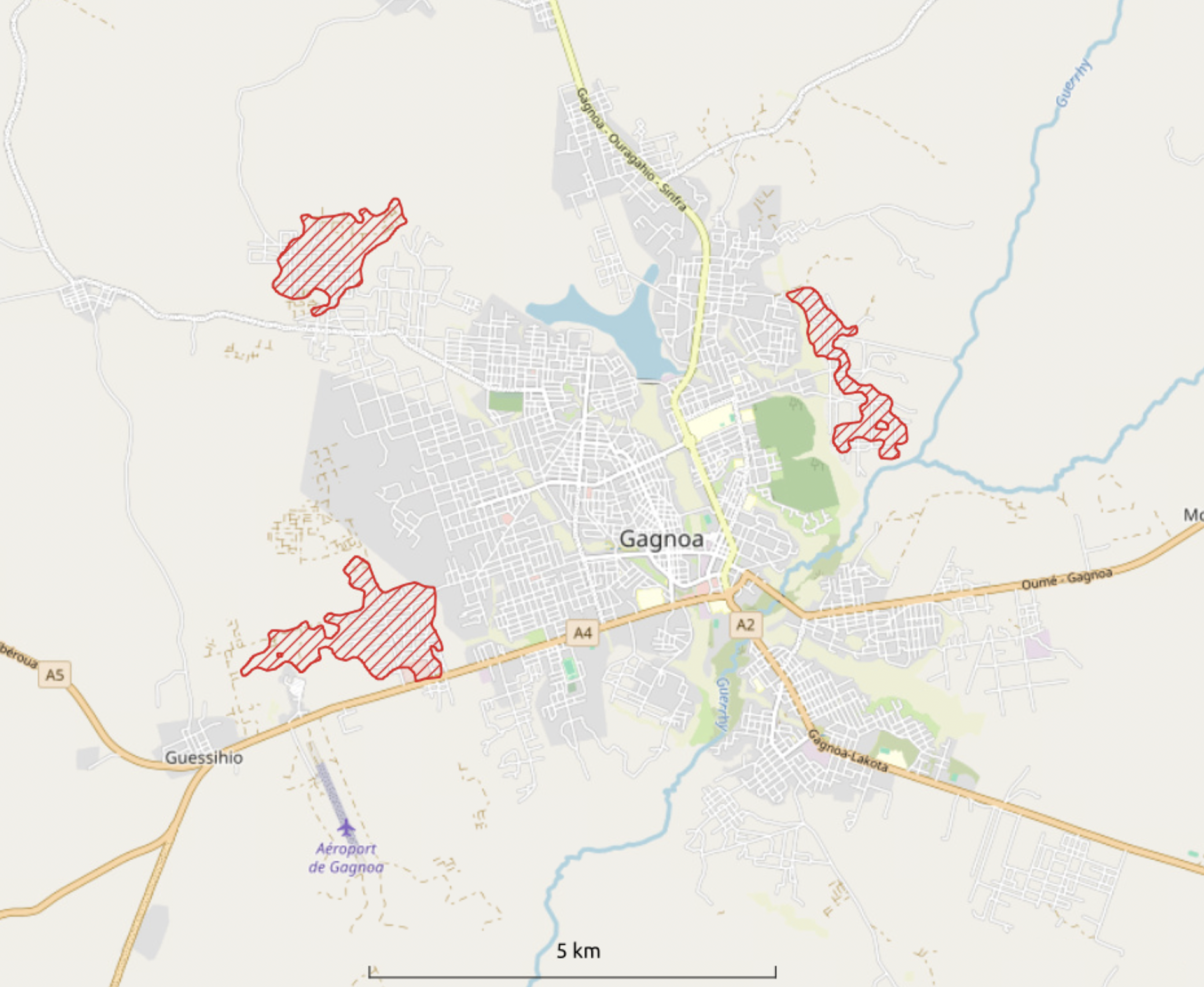
Urban expansion
Land use change
Road network density
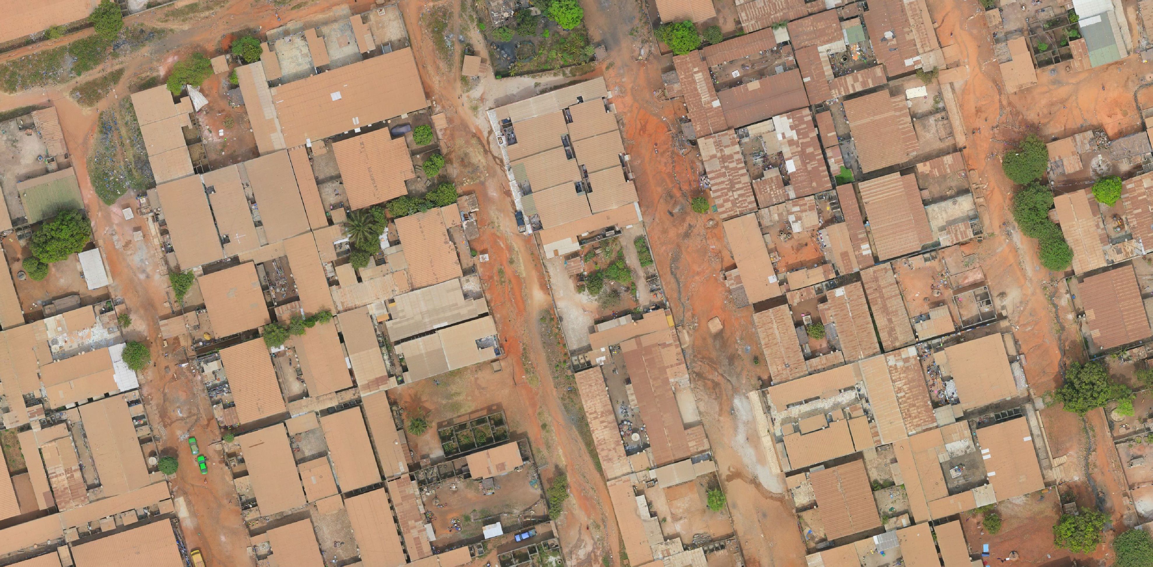
Building locations and density
Analysis of movements between cities
Road traffic volume
Geolocation of various business types (competition analysis)
Business density by sector (supermarkets, banks, gas stations, etc.)
Land price mapping
Forest cover and deforestation
Vegetation cover
Illegal mining detection
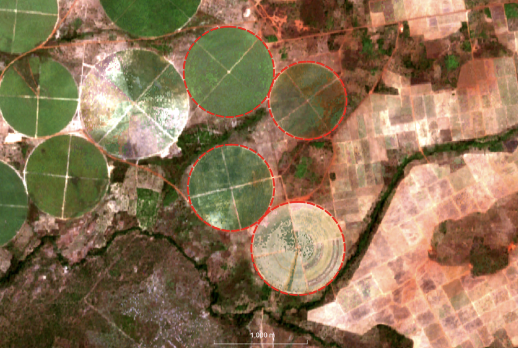
Commercial crop mapping
Mapping of agricultural burn scars
Overview of agricultural land quality
Monitoring of seedling growth
Recent floods and flood risks
Coastal erosion risk
Drought risk
Digital terrain models, slopes, basins, etc.
Affordable annual imagery and change visualization
Meteorological and climatic data
Mapping of water points and watersheds
Mapping of other hydraulic aspects (to be specified)
Photovoltaic potential
Mapping of educational and health infrastructure